
KalMap Revolutionizes Disaster Monitoring in Iligan and Mindanao
Iligan City, Philippines – As natural disasters continue to challenge communities across Mindanao, a new innovation is stepping up to make response faster, smarter, and more coordinated. KalMap, an AI-driven disaster monitoring and prediction system, provides real-time mapping of affected barangays during emergencies—helping responders and volunteers act when it matters most.
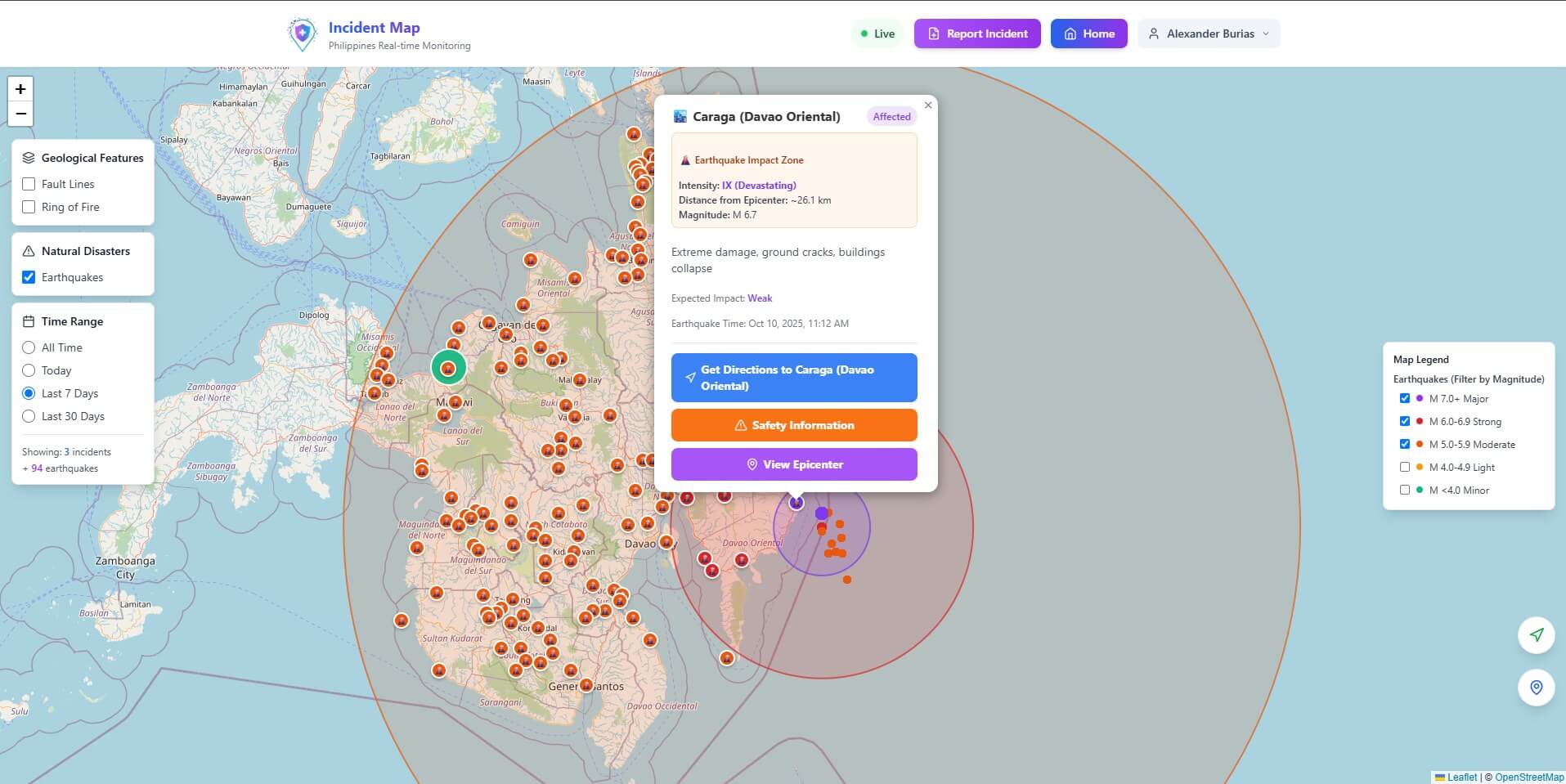
The platform, accessible at https://KalMap.org, integrates multiple hazard data sources, including earthquake, flood, and weather tracking. Through artificial intelligence, KalMap analyzes the scope of damage and risk zones automatically, allowing first responders to pinpoint priority areas and deploy resources efficiently.
Iligan and Davao Benefit from Real-Time Earthquake Impact Tracking
Recently, KalMap’s system detected and mapped the impact zones of a magnitude 6.7 earthquake near Caraga, Davao Oriental on October 10, 2025. The system identified extreme damage areas, including ground cracks and structural collapses, while marking Iligan and neighboring provinces under weak to moderate impact zones.
Key features of KalMap include:
- AI-powered incident detection for earthquakes, floods, and typhoons across the Philippines.
- Barangay-level hazard mapping for faster relief coordination and evacuation planning.
- Real-time updates with automated severity classification and distance from the epicenter.
- Integrated safety guides and response protocols accessible directly from the map interface.
By connecting data to insight to action, KalMap bridges the critical information gap during emergencies—turning complex hazard data into clear, actionable intelligence for communities and disaster management teams.
Join the Movement for a Disaster-Ready Iligan
Visit https://KalMap.org today to explore live disaster tracking across Iligan, Davao, and the rest of Mindanao. Because when disasters strike, every second counts—and KalMap ensures no one is left behind.


Recent Hot Topics
Experience GARBO 2025: Iligan’s Pride Takes Center Stage in Metro Manila
Unbeatable AirAsia Sale: Fly to Your Dream Destination for Less Than the Price of Coffee
Safety First: Iligan Engineers Lead Citywide Building Inspections After Earthquake Tremor